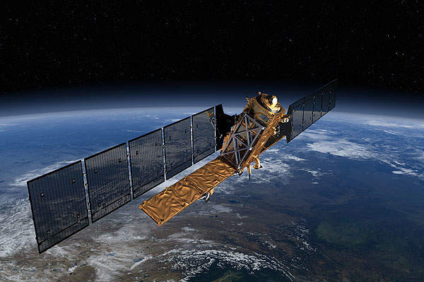
Sentinel-1A is an Earth observation satellite developed as part of the European Copernicus programme, previously known as the European Global Monitoring for Environment and Security (GMES) programme.
The Sentinel-1A programme was initiated and developed by a joint venture comprising the European Space Agency (ESA), European Commission, and the European Environmental Agency (EEA).
The satellite collects and evaluates environmental data on Earth for civil safety and humanitarian needs.
The Sentinel-1A is the first twin satellite Sentinel-1 constellation and its main objectives include land and ocean monitoring. Sentinel-1B, the second in the pair, was launched in April 2016.
The Sentinel-1 satellites provide services by covering main shipping routes across Europe and Canada.
Sentinel-1A design and development
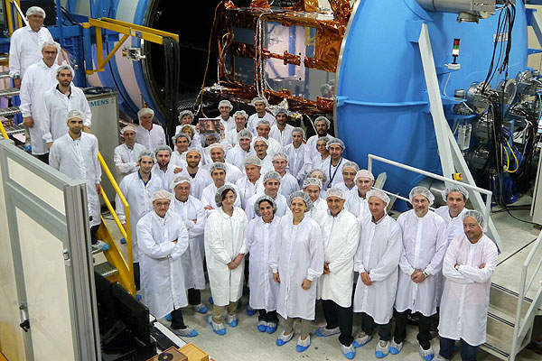
The prime manufacturing and integration contract for the Sentinel-1A satellite was awarded to Thales Alenia Space (TAS). The contractual scope included developing T/R modules and Electronic Front Ends for the synthetic aperture radar (SAR) antenna and an advanced data handling subsystem.
Astrium was awarded a contract to supply C-band SAR payload for the satellite. Astrium delivered the radar instrument system to TAS for the integration with Sentinel-1A satellite in October 2013.
The satellite was transported to Europe’s Spaceport in French Guiana in February 2014 with the help of Antonov An-124 transport plane, and underwent further tests and pre-launch operations before it was launched on 3 April 2014. Sentinel-1A delivered the first radar image of Earth in the same month of 2014.
The satellite was based on the Piattaforma Italiana Multi Applicativa (PRIMA) bus manufactured by TAS. It had a launch mass of 2,300kg and orbits Earth at an altitude of around 700km. It carries a deployable solar array and is placed in Sun-synchronous near-polar orbit.
The satellite will orbit around the planet for seven years and flies over the north and south poles of the Earth in each orbit. The radar instrument within the satellite observes the Earth and record data round-the-clock.
Environmental monitoring satellite missions
Sentinel-1A supports a broad range of environmental tasks on Earth such as surveillance of the maritime environment, monitoring the Arctic sea-ice extent and oil spills, landslides and floods.
It also provides quick and latest data for assistance when carrying out reconnaissance and operational support activities in the event of natural disasters.
The spacecraft ensures routine sea-ice mapping, ship detection for maritime security, and monitoring land-surface for motion risks. It also renders mapping for forest, water and soil management, for supporting humanitarian aid in crisis situations.
Communication systems on the Sentinel satellite
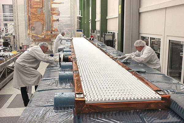
Sentinel-1A features a single C-band SAR payload. The SAR features an active electronic antenna measuring 12.30m by 0.90m. It has a beam wavelength of 6cm.
It is capable of obtaining night imagery and detecting small movements on the ground with two modes of operation, which include interferometric wide swath and extra-wide swath modes.
The first mode images the Earth in swaths of 250km diameters with a ground resolution ranging between 5m and 25m, while the second mode images the planet in swaths of 400km diameters with ground resolution ranging between 25m and 100m.
It also includes two manual-operated modes, including strip map with swaths of 80km and wave with swaths of 20km.
The communication system also includes large data storage with a capacity of 1,410GB. It is equipped with a 520MB/s capacity X-band downlink to obtain quick data in the event of natural disasters.
Launch vehicle for the European satellite
Arianespace was awarded a contract to provide launch service and solutions for the Sentinel-1A satellite in December 2010.
The satellite was launched on a Soyuz rocket from Guiana Space Centre located at Europe’s Spaceport in French Guiana on 3 April 2014.
Sentinel-1A ground control station
The ground segment of the Sentinel series satellites comprises three elements, which include GSC core ground segment, the GSC collaborative ground segment, and the GMES contributing mission’s ground segment.
DLR was awarded a contract to provide Laser Communication Terminal (LCT), which transmits data from the Sentinel-1A satellite to the European Data Relay Satellite (EDRS) using an optical laser link to transmit data back to the ground facility.
Related content
Eutelsat 25B Communication Satellite, French Guiana
Eutelsat 25B satellite is a high-power, multi-mission communication satellite, which was jointly developed by Eutelsat and Es’hailSat from Qatar and manufactured by Space Systems/Loral (SSL).
Eutelsat W7, France
Eutelsat W7 is a telecommunication satellite principally used for providing high-power, direct-to-home (DTH) and digital broadcasting services to more than 450 channels from 36° East.


