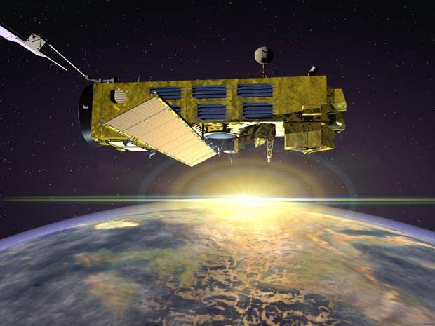
Envisat is an advanced polar-orbiting Earth-observation satellite that provides measurements of the atmosphere, ocean, land and ice. It was launched in March 2002 on an Ariane 5 rocket into an 800km polar orbit by the European Space Agency (ESA). Originally planned for five years, the life of Envisat has been extended till 2013.
Envisat uses ten different instruments and provides near-real-time (NRT) data. The NRT data helps in monitoring daily sea surface temperatures, worldwide fire maps, UV radiation levels and ozone forecasts.
The satelite also helps scientists access data for analysing long-term climatic changes.
The polar platform (PPF) has two elements: the service module (SM) and the payload module (PLM). The SM houses the main satellite support functions, such as command and control, communications with the ground, power, attitude and orbit control, and propulsion. The PLM houses Envisat instruments and PPF payload support equipment (data management and communications, and electrical distribution).
Around ten optical and radar instruments are carried by Envisat to gather data on the Earth’s atmosphere, the oceans and the polar icecaps. It also provides information on the various changes occuring in climatic conditions.
Instruments aboard the PLM include: Michelson interferometer for passive atmospheric sounding (MIPAS), global ozone monitoring by occultation of stars (GOMOS), scanning imaging absorption spectrometer for atmospheric cartography (SCIAMACHY), medium-resolution imaging spectrometer (MERIS), advanced along track scanning radiometer (AATSR), advanced synthetic aperture radar (ASAR), radar altimeter 2 (RA-2), microwave radiometer (MWR), doppler orbitography and radiopositioning integrated by satellite (DORIS), and laser retro-reflector (LRR).
The ASAR provides maximum coverage, range of incidence angles, polarisation and modes of operation by operating in C band.
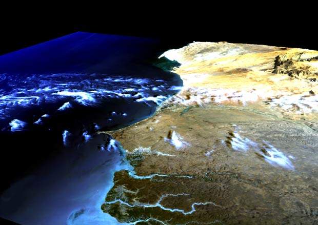
MERIS measures the solar radiation reflected by the earth with a spatial resolution of 300m, with 15 spectral bands in visible and near infrared and programmable in width and position. MERIS covers the entire globe every three days.
Envisat data will support Earth science research and allow monitoring of the evolution of environmental and climatic changes. It will also facilitate the development of operational and commercial applications.
The data provided by Envisat has helped scientists studying the atmosphere of littoral zones, radar technology and interferometry, winds, surface waves, vegetation and agriculture, oil exploration, ocean colours, tracking of oil pollution at sea and monitoring ice caps.
Envisat polar platform
The Envisat polar platform is configured to maximise the space available for instruments. The instruments include two radar instruments, three spectrometers of different types and measurement characteristics, two different radiometers (broad and narrow band), the first high-resolution spaceborne interferometer for long-term observation and two instruments for range measurements.
Satellite testing
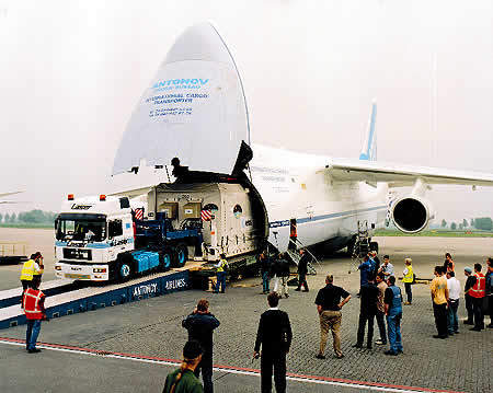
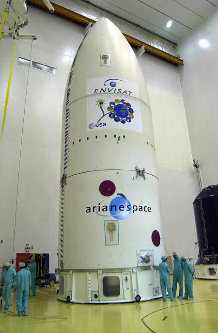
The Envisat satellite went through its last testing in January 2001. The tests were conducted at the ESA Test Centre in Noordwijk, the Netherlands, before the satellite was shipped to Kourou for launch. For transport, Envisat was put into two large containers: a payload module container and a service module container. Getting all the equipment out to the French dependency was a major task involving the transport of machinery by air, land and water.
The launch had originally been intended for July 2001, but this date was thrown back after problems were discovered in the upper stage of the rocket. The ignition of the rocket’s Aestus engine was unsatisfactory. The satellite was finally launched in March 2002.
Envisat ground operations
The ground segment has two major elements. The flight operation segment has command and control of the satellite. The payload data segment is responsible for instrument data. The ground stations are at Kiruna, Fucino, Svallbard and Villafranca. The last is responsible for TT&C back-up.
When the satellite is not visible, the ground stations receive data through the ESA data relay satellite system Artemis. The flight operations control centre (FOCC) is located at ESOC in Darmstadt, Germany.
Construction
The development and construction of the 8,200kg spacecraft took more than ten years, with the involvement of almost 100 companies in 14 countries. Astrium UK was the prime contractor to ESA for two of the major instruments and the polar platform. Astrium Germany was mission prime to ESA with overall responsibility for the instruments, the payload equipment bay and two instruments specifically. Astrium (France) had responsibility for the service module and other instruments.
Envisat also has a number of other companies involved in the construction. Thomson-CSF Services & Systemes Sol Spatiaux is prime contractor responsible for overall programme management, central procurement of hardware and software, system engineering, and system validation and acceptance for the payload data segment.
The PPF construction is led by Matra Marconi Space in Bristol, UK, which is also responsible for the final satellite integration and preparation for launch. Dornier Satellitensysteme, Germany has major development responsibility for payload equipment bay, which is part of the payload module, and Matra Marconi Space in Toulouse, France, is leading the service module development.


