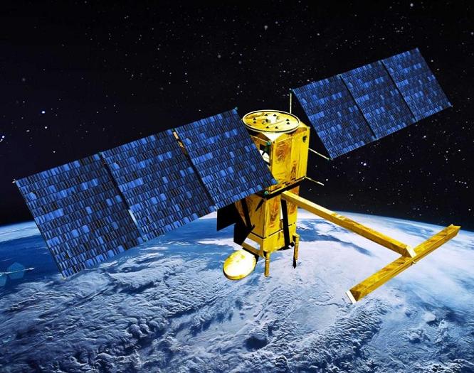
French space agency Centre National d’Etudes Spatiales (CNES) has awarded a contract to Thales Alenia Space to build an oceanography satellite.
The Surface Water and Ocean Topography (SWOT) satellite is designed to study ocean topography and surface water on the continents, and provide measurements of ocean surfaces and wave height.
The SWOT programme is collaboration between Nasa and the CNES, and follows Jason-1, 2 and 3 missions.
Under the contract, Thales Alenia Space will develop a new-generation platform for SWOT with a controlled atmospheric re-entry capability at the end-of-life of the satellite.
The company will also be responsible for satellite assembly, integration and testing, delivery to the launch centre, and launch operations.
SWOT’s payload will comprise two subassemblies, Ka-band Radar INterferometer (KaRIn) and NADIR.
How well do you really know your competitors?
Access the most comprehensive Company Profiles on the market, powered by GlobalData. Save hours of research. Gain competitive edge.

Thank you!
Your download email will arrive shortly
Not ready to buy yet? Download a free sample
We are confident about the unique quality of our Company Profiles. However, we want you to make the most beneficial decision for your business, so we offer a free sample that you can download by submitting the below form
By GlobalDataWith two Ka-band antennas, KaRIn will offer two-dimensional observation capability over a 120km-range, with a horizontal resolution of around 100m. It will provide coverage of lakes, rivers, reservoirs and oceans twice every 21 days.
NADIR module will have similar instruments as in the Jason satellites as well as the Thales-built Doris system, an advanced microwave radiometer, GPS payload and a laser retro-reflector array.
Planned to be launched in 2020, the SWOT will be located at an altitude of 890km with an inclination of 77.6° and will operate for around three years.
Data from the SWOT will help evaluate the impact of coastal circulation on marine life, ecosystems, water quality and energy transfers.
The satellite will also study changes in water storage in humid zones, lakes and reservoirs, as well as flow rates in rivers.
Image: An artistic view of SWOT oceanography satellite. Photo: courtesy of Thales Group.


